
White Nile topographic map
Interactive map
Click on the map to display elevation.
About this map
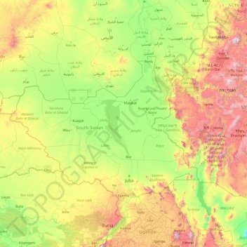
Name: White Nile topographic map, elevation, terrain.
Location: White Nile, South Sudan (0.41536 30.20963 15.64124 33.19629)
Average elevation: 799 m
Minimum elevation: 253 m
Maximum elevation: 4,311 m
Other topographic maps
Click on a map to view its topography, its elevation and its terrain.
Awoda
South Sudan > Northern Bahr el Ghazal > Aweil Centre
Awoda, Aweil Centre, Northern Bahr el Ghazal, South Sudan
Average elevation: 571 m
Nahr al Jur
South Sudan > Western Bahr el Ghazal
Nahr al Jur, Western Bahr el Ghazal, South Sudan
Average elevation: 546 m
White Nile
South Sudan > Upper Nile > Malakal
White Nile, Malakal, Upper Nile, South Sudan
Average elevation: 393 m