
Limodre topographic map
Interactive map
Click on the map to display elevation.
About this map
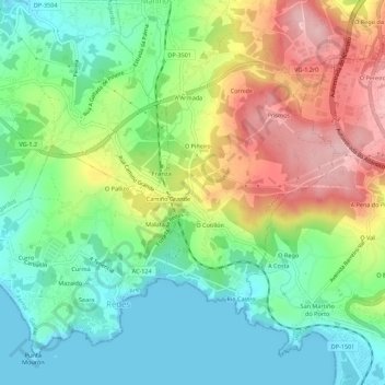
Name: Limodre topographic map, elevation, terrain.
Location: Limodre, Comarca de Ferrol, A Coruña, Galicia, 15627, España (43.41562 -8.21306 43.45562 -8.17306)
Average elevation: 73 m
Minimum elevation: 0 m
Maximum elevation: 191 m