
Hassa topographic map
Interactive map
Click on the map to display elevation.
About this map
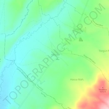
Name: Hassa topographic map, elevation, terrain.
Location: Hassa, Pınarbaşı, Kayseri, Central Anatolia Region, Turkey (38.71760 36.09063 38.75760 36.13063)
Average elevation: 1,508 m
Minimum elevation: 1,452 m
Maximum elevation: 1,643 m