
Lisemeng 1 topographic map
Interactive map
Click on the map to display elevation.
About this map
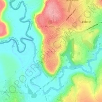
Name: Lisemeng 1 topographic map, elevation, terrain.
Location: Lisemeng 1, Leribe District, 0300, Lesotho (-28.89841 28.02202 -28.85841 28.06202)
Average elevation: 1,596 m
Minimum elevation: 1,549 m
Maximum elevation: 1,673 m