
Williamsport topographic map
Interactive map
Click on the map to display elevation.
About this map
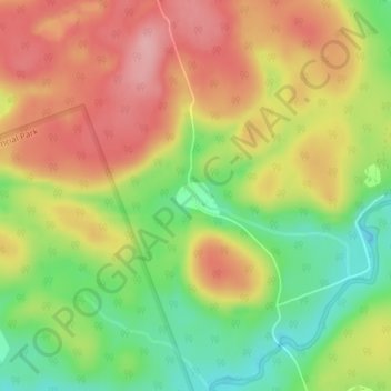
Name: Williamsport topographic map, elevation, terrain.
Average elevation: 358 m
Minimum elevation: 285 m
Maximum elevation: 423 m
Other topographic maps
Click on a map to view its topography, its elevation and its terrain.
Port Sydney
Canada > Ontario > Huntsville
Port Sydney, Huntsville, District Municipality of Muskoka, Muskoka District, Ontario, P0B 1L0, Canada
Average elevation: 308 m