
Tombelaine topographic map
Interactive map
Click on the map to display elevation.
About this map
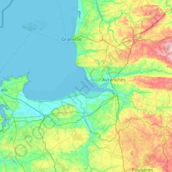
Name: Tombelaine topographic map, elevation, terrain.
Average elevation: 67 m
Minimum elevation: 0 m
Maximum elevation: 343 m
Other topographic maps
Click on a map to view its topography, its elevation and its terrain.
Tombelaine
Tombelaine, Genêts, Avranches, Manche, Normandie, France métropolitaine, 50530, France
Average elevation: 0 m