
Ponte Caldelas topographic map
Interactive map
Click on the map to display elevation.
About this map
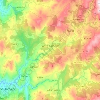
Name: Ponte Caldelas topographic map, elevation, terrain.
Location: Ponte Caldelas, Pontevedra, Galicia, España (42.33714 -8.59516 42.43043 -8.43169)
Average elevation: 337 m
Minimum elevation: 0 m
Maximum elevation: 728 m
Other topographic maps
Click on a map to view its topography, its elevation and its terrain.
Mirón
España > Galicia > Pontevedra > Ponte Caldelas
Mirón, Tourón, Ponte Caldelas, Pontevedra, Galicia, 36828, España
Average elevation: 303 m