
District of Bratislava IV topographic map
Interactive map
Click on the map to display elevation.
About this map
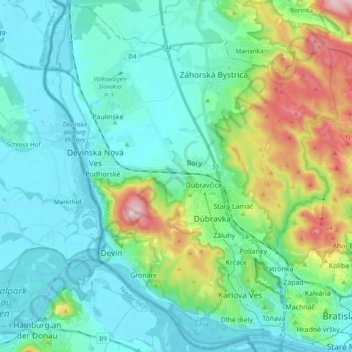
Name: District of Bratislava IV topographic map, elevation, terrain.
Average elevation: 215 m
Minimum elevation: 136 m
Maximum elevation: 501 m
Other topographic maps
Click on a map to view its topography, its elevation and its terrain.
Devín
Slovakia > Region of Bratislava > District of Bratislava IV
Devín, District of Bratislava IV, Bratislava, Region of Bratislava, Slovakia
Average elevation: 238 m