
Pedrosa topographic map
Interactive map
Click on the map to display elevation.
About this map
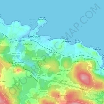
Name: Pedrosa topographic map, elevation, terrain.
Location: Pedrosa, Mariña Occidental, Lugo, Galicia, 27890, España (43.66796 -7.45181 43.70796 -7.41181)
Average elevation: 36 m
Minimum elevation: -2 m
Maximum elevation: 148 m