
Shari topographic map
Interactive map
Click on the map to display elevation.
About this map
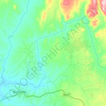
Name: Shari topographic map, elevation, terrain.
Location: Shari, Bunia, Ituri, RD Congo (1.45811 29.84963 1.55107 29.99103)
Average elevation: 974 m
Minimum elevation: 876 m
Maximum elevation: 1,300 m
Other topographic maps
Click on a map to view its topography, its elevation and its terrain.