
West Orange topographic map
Interactive map
Click on the map to display elevation.
About this map
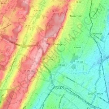
Name: West Orange topographic map, elevation, terrain.
Location: West Orange, Essex County, New Jersey, USA (40.75739 -74.30505 40.82656 -74.22089)
Average elevation: 108 m
Minimum elevation: 34 m
Maximum elevation: 202 m