
Oakbank topographic map
Interactive map
Click on the map to display elevation.
About this map
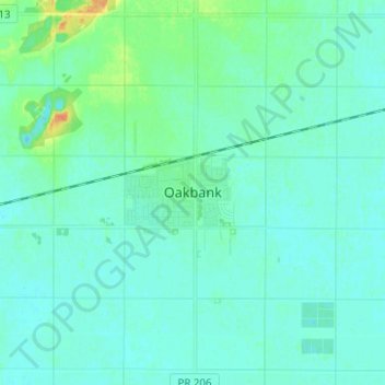
Name: Oakbank topographic map, elevation, terrain.
Average elevation: 245 m
Minimum elevation: 239 m
Maximum elevation: 270 m
Other topographic maps
Click on a map to view its topography, its elevation and its terrain.
Birds Hill Provincial Park
Canada > Manitoba > Division No. 12 > Rural Municipality of Springfield
Birds Hill Provincial Park, Rural Municipality of Springfield, Division No. 12, Manitoba, Canada
Average elevation: 249 m