
West Carleton topographic map
Interactive map
Click on the map to display elevation.
About this map
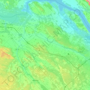
Name: West Carleton topographic map, elevation, terrain.
Location: West Carleton, Ottawa, Eastern Ontario, Ontario, Canada (45.19155 -76.35559 45.51874 -75.92036)
Average elevation: 111 m
Minimum elevation: 53 m
Maximum elevation: 345 m
Other topographic maps
Click on a map to view its topography, its elevation and its terrain.
Buckham's Bay West
Canada > Ontario > Ottawa > West Carleton > Buckham's Bay West
Buckham's Bay West, West Carleton-March, West Carleton, Ottawa, Eastern Ontario, Ontario, K0A 3M0, Canada
Average elevation: 79 m