Geolocate

Lake Wales Ridge Wildlife and Environmental Area topographic map

Click on the map to display elevation.

About this map
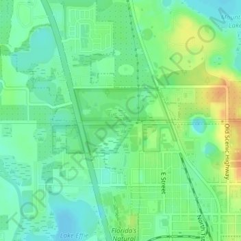
Name: Lake Wales Ridge Wildlife and Environmental Area topographic map, elevation, terrain.

Location: Lake Wales Ridge Wildlife and Environmental Area, Lake Wales, Polk County, Florida, United States (27.91703 -81.60872 27.92440 -81.59291)

Average elevation: 42 m

Minimum elevation: 28 m

Maximum elevation: 65 m

Other topographic maps

Click on a map to view its topography, its elevation and its terrain.
Lake Cooper

United States > Florida > Polk County > Lake Wales

Average elevation: 42 m

Gear up for your next adventure:

🥾Approach Boots - Comfortable boots for hiking and climbing approaches
❄️Traction Ice Cleats - Slip-on spikes for icy trails and winter hiking
⛺Lightweight Camping Tent - Portable shelter optimized for Canadian backcountry camping
🥾Mountain Trail Shoes - High-traction shoes for mountain trails
💡Compact LED Flashlight - Powerful and portable flashlight for outdoor use

As an Amazon Associate, this site earns from qualifying purchases at no extra cost to you.