
Make a donation
Gear up for your next adventure:
As an Amazon Associate, this site earns from qualifying purchases at no extra cost to you.
Randolph County topographic map
Click on the map to display elevation.
Make a donation
Gear up for your next adventure:
As an Amazon Associate, this site earns from qualifying purchases at no extra cost to you.
About this map
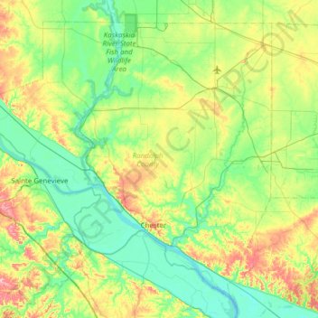
Name: Randolph County topographic map, elevation, terrain.
Location: Randolph County, Illinois, United States (37.80303 -90.20693 38.22315 -89.59265)
Average elevation: 147 m
Minimum elevation: 102 m
Maximum elevation: 259 m
Make a donation
Gear up for your next adventure:
As an Amazon Associate, this site earns from qualifying purchases at no extra cost to you.
Other topographic maps
Click on a map to view its topography, its elevation and its terrain.
Make a donation
Gear up for your next adventure:
As an Amazon Associate, this site earns from qualifying purchases at no extra cost to you.
Sturbridge Village
United States > Illinois > Winnebago County > Sturbridge Village
Average elevation: 230 m