Geolocate

Aurora Gardens topographic map

Click on the map to display elevation.

About this map
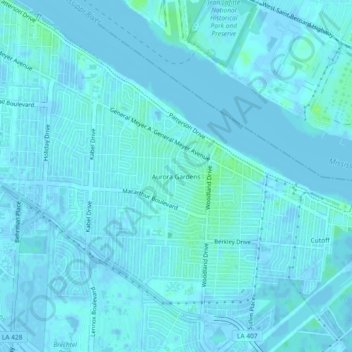
Name: Aurora Gardens topographic map, elevation, terrain.

Location: Aurora Gardens, New Orleans, Orleans Parish, Louisiana, 70131, United States (29.90520 -90.01674 29.94520 -89.97674)

Average elevation: 1 m

Minimum elevation: -4 m

Maximum elevation: 10 m

Other topographic maps

Click on a map to view its topography, its elevation and its terrain.
Gear up for your next adventure:

💧Reusable Water Bottle - Durable water bottles for hydration on trails
🧥Softshell Hiking Jacket - The perfect balance of wind protection and breathability
🧭GPS Tracker - Track your location in remote areas safely
🥾Trail Running Boots - Durable shoes designed for trail running
🥾Hiking Boots - Sturdy boots providing ankle support and traction on rugged trails

As an Amazon Associate, this site earns from qualifying purchases at no extra cost to you.