
Innisville topographic map
Interactive map
Click on the map to display elevation.
About this map
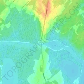
Name: Innisville topographic map, elevation, terrain.
Average elevation: 143 m
Minimum elevation: 131 m
Maximum elevation: 171 m
Other topographic maps
Click on a map to view its topography, its elevation and its terrain.
Port Elmsley
Canada > Ontario > Lanark County > Drummond-North Elmsley > Port Elmsley
Port Elmsley, Drummond-North Elmsley, Lanark County, Eastern Ontario, Ontario, K7H 3C7, Canada
Average elevation: 131 m
Balderson
Canada > Ontario > Lanark County > Drummond-North Elmsley > Balderson
Balderson, Drummond-North Elmsley, Lanark County, Eastern Ontario, Ontario, Canada
Average elevation: 153 m